Lewis and Clark played a tremendous role in mapping out the rivers of the west as they followed the Missouri River to its tributaries and looked for a passage to the Pacific. Today, there are hundreds of places that commemorate their explorations. Many of them are in Montana and a vacation or series of vacations could be built around visiting these sites, just in this state.
Last year I got interested in seeing some of the places discovered by them. I accidently stumbled over the marvelous
Lewis and Clark Interpretive Center in Great Falls. And Bob and I came across
Camp Fortunate last year while on the way to check out Red Rock Lakes NWR. This is the camp where Sacagawea was reunited with her brother and where the Expedition obtained horses.
 |
| Me in a copy of one of the boats used in the Lewis and Clark Expedition |
As I rode east out of the refuge with Steve and Cheri, on the way to the rodeo at Ennis, we passed a sign where little creek crossed the road. (
See the sign below) Steve said that the Hell Roaring Creek flowed from Browers Spring, named for the man who discovered it. This is the ultimate source of the Missouri River. That piqued my interest and I started researching this story and also started plotting to visit Browers Spring.
 |
| The sign that peaked my interest |
Lewis and other members of the Discovery Corps. thought they had discovered the source of he Missouri in the Beaverhead Mountains at the highest reaches of a little creek now known as Trail Creek. Lewis later wrote, he "thanked his god that he had lived to bestride the mighty and heretofore deemed endless Missouri.
But almost 100 years later, Jacob V. Brower, the man who confirmed the source of the Mississippi River, and urged the the state of Minnesota to preserve it as Itasca State Park, decided to search for it. Lewis and Clark had named the three rivers who come together to form the Missouri as the Galatin, the Madison, and the Jefferson. The longest of the three rivers is the Jefferson, so Browers came up this river to where it was called the Beaverhead, then on up through Red Rock Creek and Hell Roaring Creek. He hiked, along with some local up along Hell Roaring Creek until he found where it oozed out the the Mountain, about a hundred more miles further away from the place where the waterway is called the Missouri. This point is about 100 miles further upstream that was the point on Trail Creek. At 2,341 miles, the Missouri is the longest river in the United States, but is not quite endless.
 |
One of three branches of Hell Roaring Creek which fills the roadside ditch
before going through one culvert on its way to Red Rock Creek
|
I learned that the spring was about five miles upstream from this sign. Then I learned that the actual way to reach it was to go up Sawtell Mountain and hike the Sawtell Trail to it. I put this near the top of the things I wanted to do while at Red Rock Lakes. The last weekend before I left, I realized that I had to do this or forget about it for this year. I finally got myself organized to hike there. I did a little research and found the coordinates listed in Wikipedia. Dave, the Deputy Project Leader, had hiked up there a week or so before and told me I only had to hike about two miles to reach the spring.
 |
| Sawtell Mountain |
 |
The road to Sawtell Mountain looked more like a bowl of spaghetti
than a road. Can you see another piece of road in the center of the picture? |
 |
| View from Sawtell Mountain |
I first visited the top of Sawtell mountain, of course stopping frequently to take pictures as I drove up the tight switchbacks, then drove back down to the trailhead and began my hike. My GPS beeped to tell me I had arrived at Brower Springs when I reached the top of Sawtelle Mountain. I planned to get the true coordinates and edit Wikipedia so others could have the correct coordinates. And I even had the forethought to take the coordinates for the trailhead.
The day was gorgeous and I was walking on or close to the Continental Divide. The trailhead had no maps but I thought the trail I was on was going to end at Hell Roaring Creek. Soon I was spending as much time taking pictures as I was walking. I was walking through flowering meadows, amid the sounds of buzzing bees, watching dancing butterflies and darting little birds. Lots of sparrows and American goldfinches were active in spots. I was on the spine of the Continental Divide where water could run either to the Gulf or to the Pacific, depending on just a few feet of difference.
 |
| Many species of wildflowers grew riotously |
 |
| One of many species of butterflies |
 |
| There were lots of different flowers |
 |
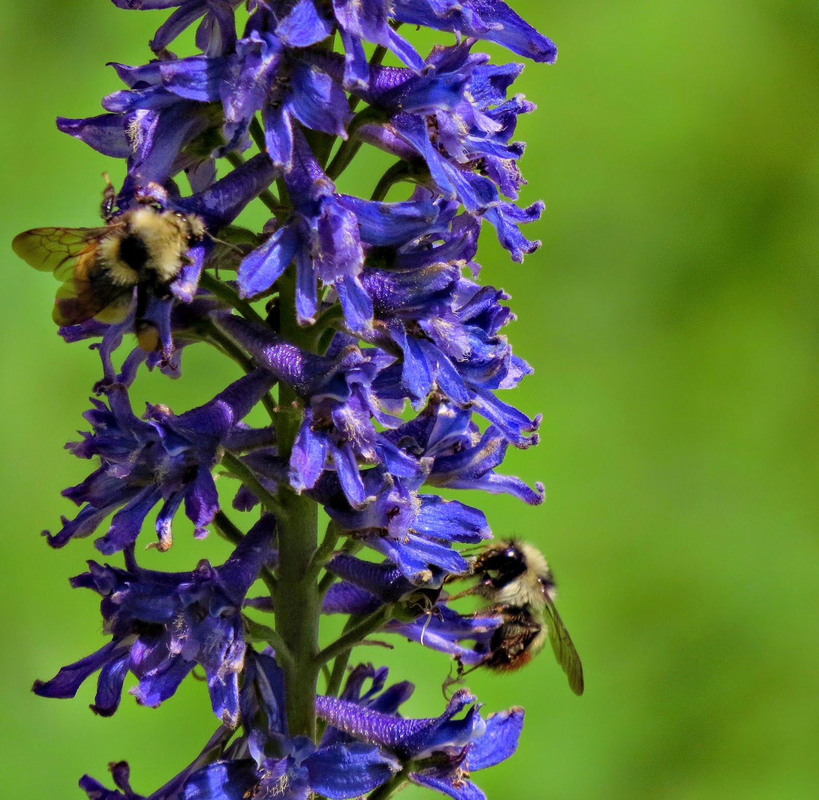
| Bees on larkspur |
 |
| View down to Henry's Lake, on the Pacific side of the divide |
 |
| The trail was well defined but very narrow |
 |
| Chipping sparrow |
When I didn't see the spring, I just kept on walking, missing it entirely, and walking to the end of the trail. So instead of a four mile hike, I ended up walking almost ten miles. I wasn't in physical shape for that long a walk, and I ran out of water. Then I tripped over my hiking pole and took a really hard fall on top of my camera. The camera survived but my ribs didn't. I'm still taking painkillers and moving slowly.
 |
| Trail View |
 |
| An interesting mountain face |
 |
| I think this is the remains of caldera |
 |
| The end of the trail |
 |
| Brower's Spring by Jophn9546 - what I didn't see |
Currently I'm having a great visit with my daughter and son-in-law in Ottawa, Canada. More about that in the next blog.


No comments:
Post a Comment